Thursday, September 28, 2023

BUSINESS TRAVEL & POTA: IT’S AS SIMPLE AS ONE … TWO … THREE! by VINCE VE6LK

As always there are lots of links within the article. Click one! Click them all! Learn all the things! 🙂

The backstory

For those of us that work from home there are good and not-so-good things about it. One of the not-so-good things is that I’m not getting out somewhere every day like I used to, thus I embrace corporate travel as it represents a mini-escape from the day-to-day activities that would normally happen.  It also gives me an opportunity to operate in the field and away from the comfort of sites nearby my home.

In late September I was in the Edmonton Alberta area for work and, as always, I brought along a set of gear to play radio. Where I’d normally drive up and park my F-350 within the boundaries of the park and operate from the cab of the truck, this time I was in a rental vehicle so I had to be well-equipped for the unknowns. I also didn’t pre-plan my stops like I normally would, I just wanted to roll up and do my best to make it work.

These would all be CW activations at QRP power and are part of my 200 CW activation contacts per month personal goal to improve my CW skills. (Spoiler alert: I hit the goal while writing this article!) See below for my kit list that made this possible.

Not really pre-planning an activation is a stark contrast to how I normally roll as I usually pore over maps and satellite views on multiple websites to visualize where the park entrance is and where I’ll set myself and what I may encounter for surroundings when I get there. I know exactly where I’m going and just about down to the parking space. I build a set of kit up to support that/those activation/s.

With the lovely autumn weather we were experiencing in Alberta, my plan was to activate after work opportunistically around Edmonton – something I’d not yet done despite many trips to the area – and set up and operate right around 0000z. This time is after my workday, so a nice mental break from the day’s activities before kicking back for the evening. I think to my self that I’ll roll into a site nearest to where I was working arriving just before midnight UTC (1800h local) and get set up and start calling once the clock ticked over into a new day. From there I would then head to the hotel (or home) and grab a bite to eat and close my day off on a high note.

Day One: Lois Hole Centennial Provincial Park (VE-1185)

Sometimes directions aren’t so clear, am I right?

Despite some navigational challenges, I found the park! Lois Hole Centennial Provincial Park (VE-1185) is located within the city of St. Albert and has multiple entrances. My Garmin RV780 GPS lists many parks – handy for a POTA activator – but it wanted to, strangely, lead me away from the signed entrance I could see ahead of me. I abandoned the technology at this point and did some good old dead-reckoning and turned left into the park.

It’s Sunday evening and the lot is darn near full with families enjoying the warm weather along with a few photographers doing photoshoots in the evening sun. I found a spot to park and begin scouting out the area. My small tub of kit is not conducive to carrying long distances given it’s shape and weight, so I operated near the vehicle and not by the trailside. The lot is surrounded by large landscaping boulders and a couple are flat-topped – one of these made a perfect desk of sorts!

Pink string winder is the end of the counterpoise and brightly coloured so people don’t walk into the wire

Job one was to fasten my carbon fibre fishing pole to a nearby parking sign. I set it in the ground with the fishing rod holder and figured out a way with a carabiner and small length of string to loosely affix it to the top of the signpost – this served to support it in an upright position. Naturally I was already beginning to gather onlookers …

The signpost was both too close and too far away from lot-side boulders to deploy a Spark Plug Gear 66′ EFHW so out came the other wire antenna I brought along from Tufteln which is a 41’/17′ random wire. Yes, I chose the antenna based on boulder placement–sometimes one must do these things.

Anyways, one end got clipped to the top of the mast with an S-hook and up went the mast. The rock was about 50′ away so that made the feedpoint ~9′ from my operating position. I attached the counterpoise wire but now needed to place it where nobody would trip on it… so it was brought to the rock I used as a desk and I sat the tub on top of the wire to both tension the antenna and then take the remaining 10′ and stretch it out on the ground behind me. This configured the antenna as a sloper.

After this activity, I attracted a small crowd and one person who was quite interested told me about their latent interest in CB radio – all while I was plugging in my KX3 and such. He talked for about 20 minutes while I hunted a few people and explained what I was doing, and my plans to have a completed the activation before 0000z were nixed just that easily, but in the spirit of giving good information about the hobby. I directed him to my website and the page on how to get your license.

My onlooker left at about 2355z so I began to get set up to be spotted. Thanks to good cell service (at all three sites in this story) fortunately this was simple. I opened up my notebook – something I don’t normally do as I electronically log – and began to fill out a log for hunters. I found the handwriting to be strangely enjoyable and began thinking to myself that perhaps K4SWL was right about this all along! I may have to do this more often.

The activation itself was simple and fun with a number of familiar hunters dropping by, and I packed up to head for the hotel once the sun set behind the trees and I began to get cold.

Day Two: Fort Augustus and Fort Edmonton National Historic Site (VE-6084)

The only thing I had to go on to find this POTA site were some scant directions on the Parks Canada website but they didn’t quite align to the roads’ names in either my GPS or maps on my phone. At least the Parks website showed a photo of a stone marker denoting the spot. So I had to dead reckon this one to find it.

I was now well outside any city and in farm country. I was about 2 miles off the highway and found the point without too much trouble as it happened. I arrived at the site – a monument to Fort Augustus and Fort Saskatchewan – and see a trail marker for the Trans-Canada Trail a.k.a. The Great Trail of Canada a.k.a. VE-5082. This would be a two-fer!

At the roadside, the site is a stone cairn monument surrounded by wooden fencing denoting the trailhead. It’s then that I reminded myself of the POTA rule that “you and all your gear must be within the boundaries of the park” and began taking stock of how I’d set up.

There weren’t any landscaping rocks nor flat surfaces of any sort where I could place my radio, and the shape I’m in – round – doesn’t easily lend itself to sitting on the ground for extended periods of time. Fortunately I’d borrowed a lawn chair so that made this activation comfortable.

Once again the carbon fibre fishing pole to the rescue along with the Tufteln 41’/17′ random wire.

The fishing rod was held in the ground with the rod holder and I used the shock cord from the Tufteln winder along with a small dollar store carabiner to help secure the mast to the corner fence post rail. There were two points of support for the mast just like the day before.

Repeat things that work well for you is the lesson here.

The wire ran over top of the wayfinding sign at the opposite end of the fenced enclosure and the far end of the wire was gently looped around a tree branch. This time the elevation was 20′ down to about 6′ at the far end.

I placed the gear near the chair and thought about how I was going to put it all near me, for I’d never done an “all the gear in my lap” activation before. It was simple, as it turned out, thanks to a magnetic base on my key. The battery between my knees, the KX3 on my lap and sitting on top of my notebook and the key on the armrest of the chair – perfect!

The sun was on my face and I had a wonderful view of the river valley and farmlands while I activated. I stayed longer this time, but once again packed up when the sun dipped down and the temperature dropped.

Listen in here on this short video as I show my setup from my seated point of view and at the end of the activation.

Day Three:  J.J. Collett Natural Area (VE-3049)

On my trip home I wanted to squeeze in one more activation.

Between Edmonton and my home in Okotoks there are few entities that are near the highway, so I selected J. J. Collett NA as I’d been there before and knew what I was getting into. I needed to activate quickly and move on as the weather was threatening a bit of rain.

The fencing that surrounds the parking lot is post and rail construction, so it was really easy to affix the fishing pole at the corner.

I was able to set the pole into the ground without need for the fishing rod holder thanks to the rough landscape, and anchored it into place with the shock cord and carabiner wrapped around the post and rail once again. I knew I’d be using the shock cord because my mind was already made up to deploy the 41’/17′ Tufteln again as I’d had good luck with it thus far and set-up time is under 5 minutes.

What was different for me at this set-up was how I configured the antenna: while normally I’d set it up as a sloper or flat-top, this time I opted for inverted vee style as it’s what I had to work with.

I have one ounce fishing weights on the ends of the wires and they came in handy at this location as I placed the weights gently on the top rail of the fence to secure the wire in place. I find that a small weight on the end of the light gauge wire will also help it to stay in place if you simply place it on an object like the top rail of a wooden fence. This works well enough if it’s not a windy day.

Look closely along the fence rail to see the weight, and the wire running through a crack in the wood for stability (click image to enlarge)

I tuned around a bit to figure out what frequency was open for my use. This site has moderate cell service and I’m experimenting with different techniques as always.

I loaded up the antenna for 14069, then tuned to 14074 and plugged in the hand mic. Astute readers will note this would be normal configuration for FT8, a mode I rarely use. In the context of POTA it is also used for SOTAmat spotting. If you haven’t seen SOTAmat here’s a great video about it by the author. I sent my packet of data for spotting then quickly returned to my chosen frequency of 14067 and began calling.

I didn’t wait long at all before I had a lineup of hunters! This time I was operating while standing at the tailgate of the truck as I’d already returned the loaned chair to its rightful owner. Note to self: add a folding chair to the kit. But then at about QSO number 11, the wind suddenly took a turn and the temperature dropped so I hastily packed up. I drove through rain just a few minutes after departure.

List of gear used for these activations:

Gear brought along but not used

Summary

You don’t need an exhaustive list of gear to do what I did. A radio, battery, tuner, feedline, antenna and key along with something to log are the minimums. The rest of my kit makes my set-up easier to deal with on the fly.

I hope that something from my kitlist inspires you to go out and hunt or activate as well as get out of the house too.

After all, it’s as simple as One .. Two .. Three!

72 and dit dit,
…Vince

First introduced to the magic of radio by a family member in 1969, Vince has been active in the hobby since 2002. He is an Accredited examiner in Canada and the USA, operates on almost all of the modes, and is continually working on making his CW proficiency suck less. He participates in public service events around Western Canada and is active on the air while glamping, mobile, at home or doing a POTA activation. You can hear him on the Ham Radio Workbench podcast, follow him on Twitter @VE6LK, and view the projects and articles on his website. 

HF APRS & HF Winlink on ANDROID Deviceas by Julian OH8STN

Hello Operators.
We have finally arrived at something special. It is a pleasure to announce the arrival of HF APRS & HF Winlink to Android devices. This update comes to the community via an updated Robust Packet TNC called the Teensy RBR TNC. The Teensy is a Robust Packet TNC, enabling HF APRS and HF Winlink on Android (and soon iOS) devices. Based on the SCS Tracker discontinued in 2020, the Teensy enables APRS Tracker, KISS Mode TNC, RPR WInlink … on:

  • WoAD app (Winlink on Android Device (KISS Mode)
  • HF APRS on APRSDroid app (KISS Mode
  • Winlink Express Windows (RPR)
  • PAT Winlink Linux/Windows, … (RPR)
  • Stand-alone Tracker with integrated GPS

The Teensy can function as a fully stand-alone APRS Tracker. It has its own internal GPS, and external GPS antenna port. It can also function in KISS mode or RBR, expanding its utility to applications not supporting RPR natively.

The Teensy uses a 6 pin mini-din port compatible with the SCS Tracker for connectivity between itself and your radio. It also has a micro-usb port ( yeah I know 🙁 ) for connectivity between itself and your smartphone, tablet, or laptop.
The kit version to be released soon, has added Bluetooth to the Teensy. Bluetooth not only gets rid of the wire mess between the mobile device and Teensy, it also enables iOS application developers to implement Teensy support, without the need for attaching or certifying physical hardware to an Apple device. This is HUGE!

If you were a fan of the Mobilinkd KISS TNC, the Teensy should be very interesting for you. This first video is basically just an announcement about the Teensy RBR TNC. Once the kit is released and I have the final version in my hands, we’ll follow-up with a second video, showing the Teensy capabilities at home, and in the field.

I had hoped a turn-key version of the Teensy would be made available. This idea was shut down early on, and very disappointing. Still hoping makers like Digirig or Mobilinkd pick up the project developing their own almost ready to run versions of the Teensy in a Digirig or Mobilinkd TNC format. The files for the current version can be found at the link below.

The videos and blogs were a long time coming. I didn’t want to release another unobtainium video or blog post, to get the community all worked up, without them able to get their kicks. The reason this video and blog were posted is simple. The project files and software are already out there. This means anyone can already build their own Teensy RPR TNC. So it isn’t vaporware! It just requires Operators to put in some work to get started.

Despite early frustration, this really is an epic project. The only negative things I can say about the Teensy are the closed-source (but freely distributed) software and having no ready-to-run version. These are annoying, but definitely not show-stoppers. In fact, with developers moving toward Windows-only software modems, the Teensy is a welcome relief for those of us looking for less-complex microcontroller-based modems, independent of the Windows operating system. For this, I am immensely grateful to the Teensy development team Robert DM4RW and Peter DL6MAA.

You can build your own Teensy by downloading the docs and software here: http://robust-packet.st/teensy-rpr-tnc.html

For information on robust packet HP APRS or availability of the Teensy kit, visit http://robust-packet.st or contact Robert DM4RW.

Addendum

Why isn’t there (or is there?) an open-source data mode like ARDOP, able to operate in KISS mode, and also able to run on a microcontroller? Software modems are great with the high performance computers and mobile devices available today. However, far too often we give up wider OS support, for the convenience of a Windows-only modem. A microcontroller based KISS mode modem can run on any OS. KISS is already widely supported by application developers, and quite “easy” to implement. Seems stupid to need a Windows PC to run a VaraHF modem fo an Android smartphone over Wifi connection. The Teensy is the bridge between where we currently are, and where we should be.
Who do I have to kill to inspire the community to adopt mobile operating system support in ham radio?
Food for thought

73
Julian oh8stn
YouTube http://www.youtube.com/@oh8stn
Support my rootbeer habbit: https://paypal.me/oh8stn/2usd
Follow my backup channel on Rumble: http://oh8stn.net/rumble

Looking for other ways to support the channel?

Support the channel by shopping on ebay, at Battery Hookups or GigaParts.
For GigaParts and Battery Hookup, use my callsign for a small discount.
Alternatively, drop a little something in the TipJar. It really makes a difference.


#1634 Simpson 461-2 Digital Multimeter (part 2 of 2)

The Drums of Tonkin :: Frank and Helen Schreider’s Indonesian Expedition by Amphibious Jeep by Ashley Giordano


Photography by Frank and Helen Schreider

Frank and Helen Schreider were preparing to leave for the island of Flores, Indonesia, when the village chief in Komodo brought bad news. “There is no road at Labuhan Badjo,” he said, running a calloused thumb eastward over their map. “It starts here, at Reo.” Their map of Flores clearly showed a road, but the chief was adamant. “There is no road.”

Trusting the local intel, the Schreiders recharted their course. The extra detour by land and sea would drain their fuel and water tanks long before they reached Bajdo. With no chance to send for more gasoline to fuel their amphibious Jeep, Helen and Frank studied tide charts and US Navy nautical books, hoping for an obvious solution. But as the sky darkened, heavy waves crashed while the air’s sweet smell predicted rain. Monsoon season was quickly approaching, reminding the Schreiders that half a thousand miles of unpredictable conditions remained, potentially threatening their trans-Indonesian expedition.

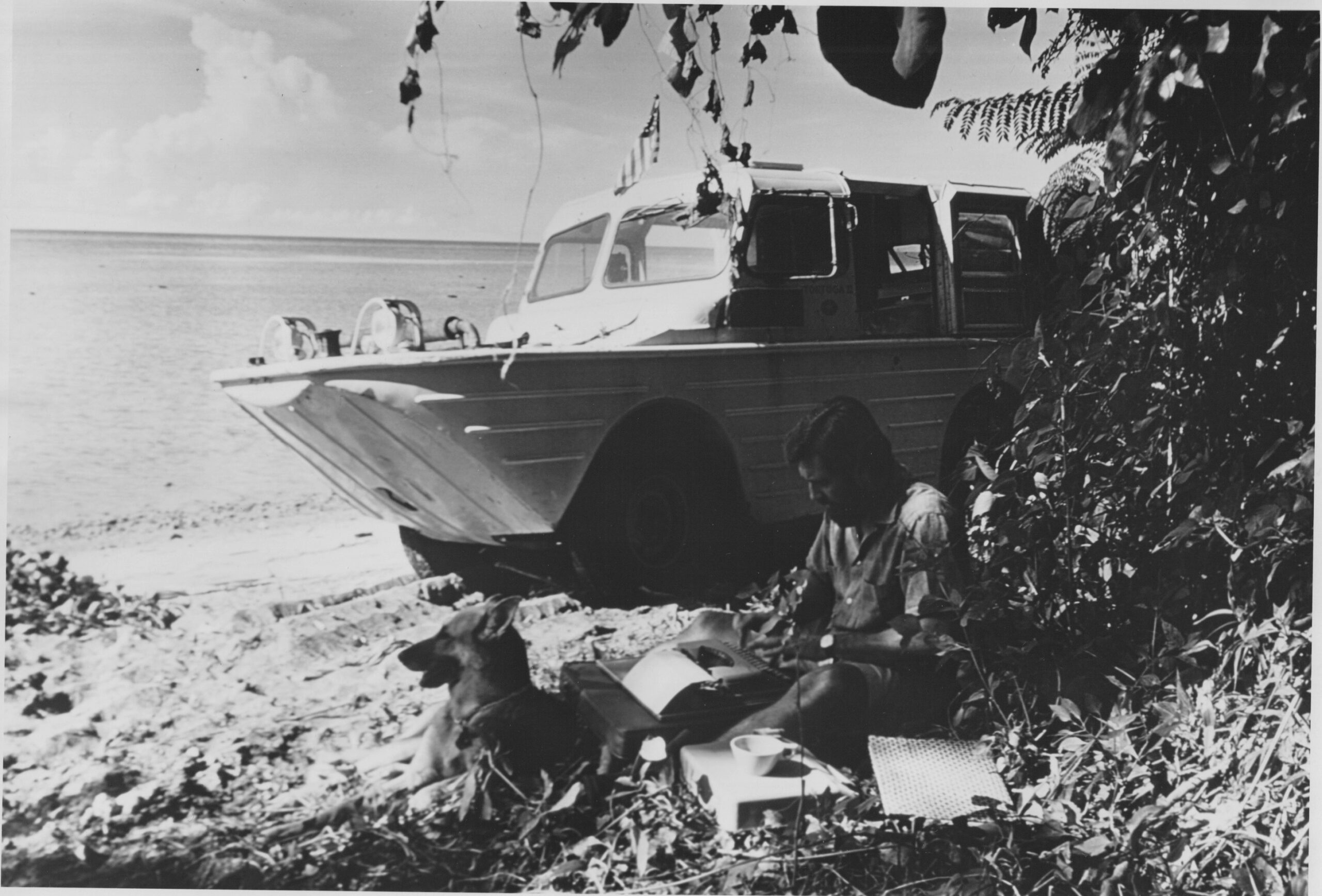
In 1961, American explorers Helen and Frank Schreider, and their trusty German shepherd, Dinah, embarked on a 5,000-mile National Geographic assignment along the Indonesian chain of islands from Sumatra to East Timor. Their vessel, Tortuga II (the Spanish word for “turtle”), was a WWII-surplus-seafaring Jeep modified to travel by road and by water—an intentional choice to traverse an archipelago of over 18,000 islands stretching nearly to the Australian coast and bordered by the Indian and Pacific oceans.

Schreiders amphibious jeep

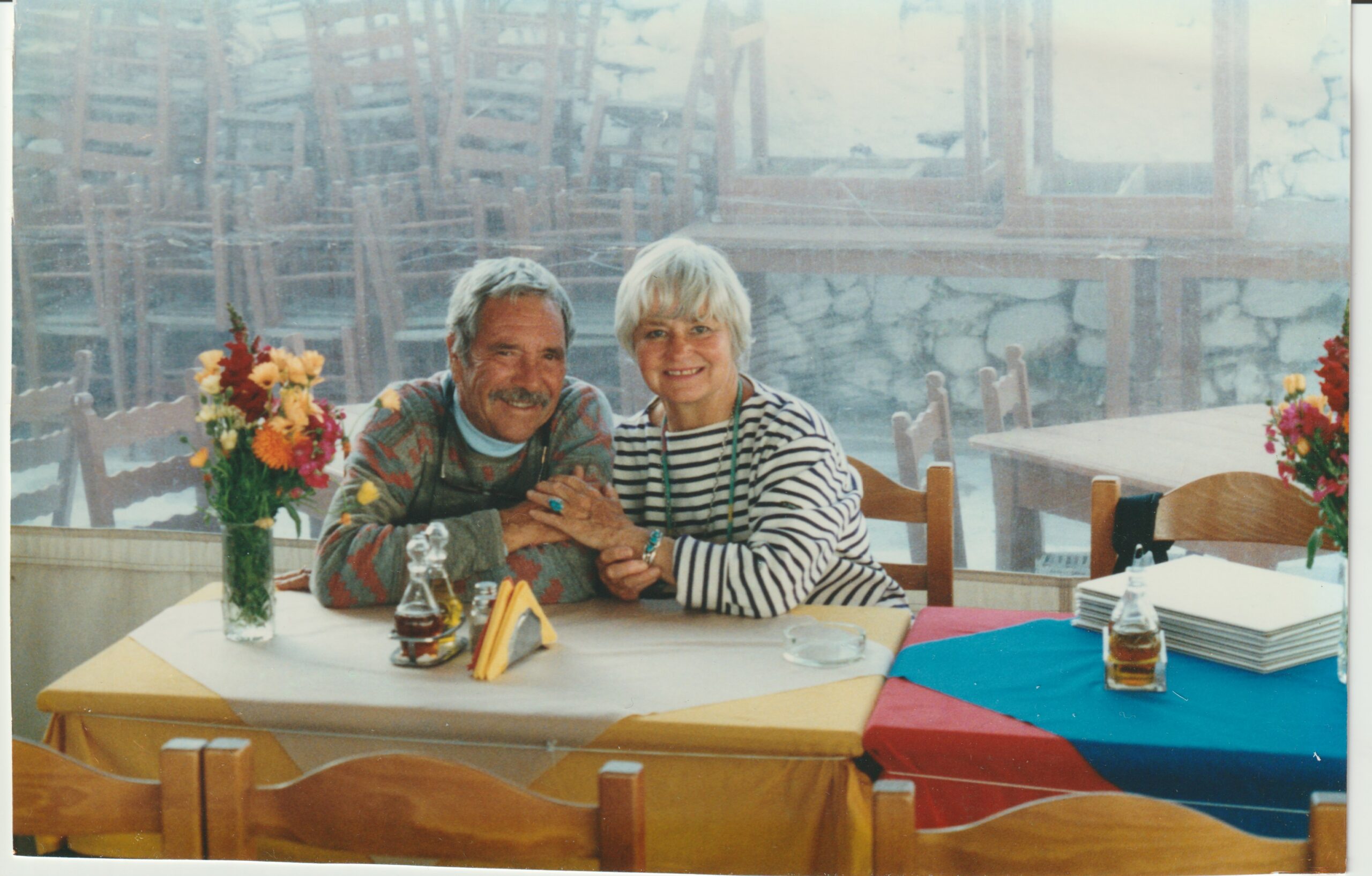
The 30-something adventurers met at the University of California in Los Angeles, where Frank studied engineering and Helen majored in fine arts. They tied the knot in 1947 and spent their honeymoon bushwhacking for eight days through 200 miles of Mexican jungle in a different Jeep, unsuccessfully penetrating the roadless track in southern Costa Rica.

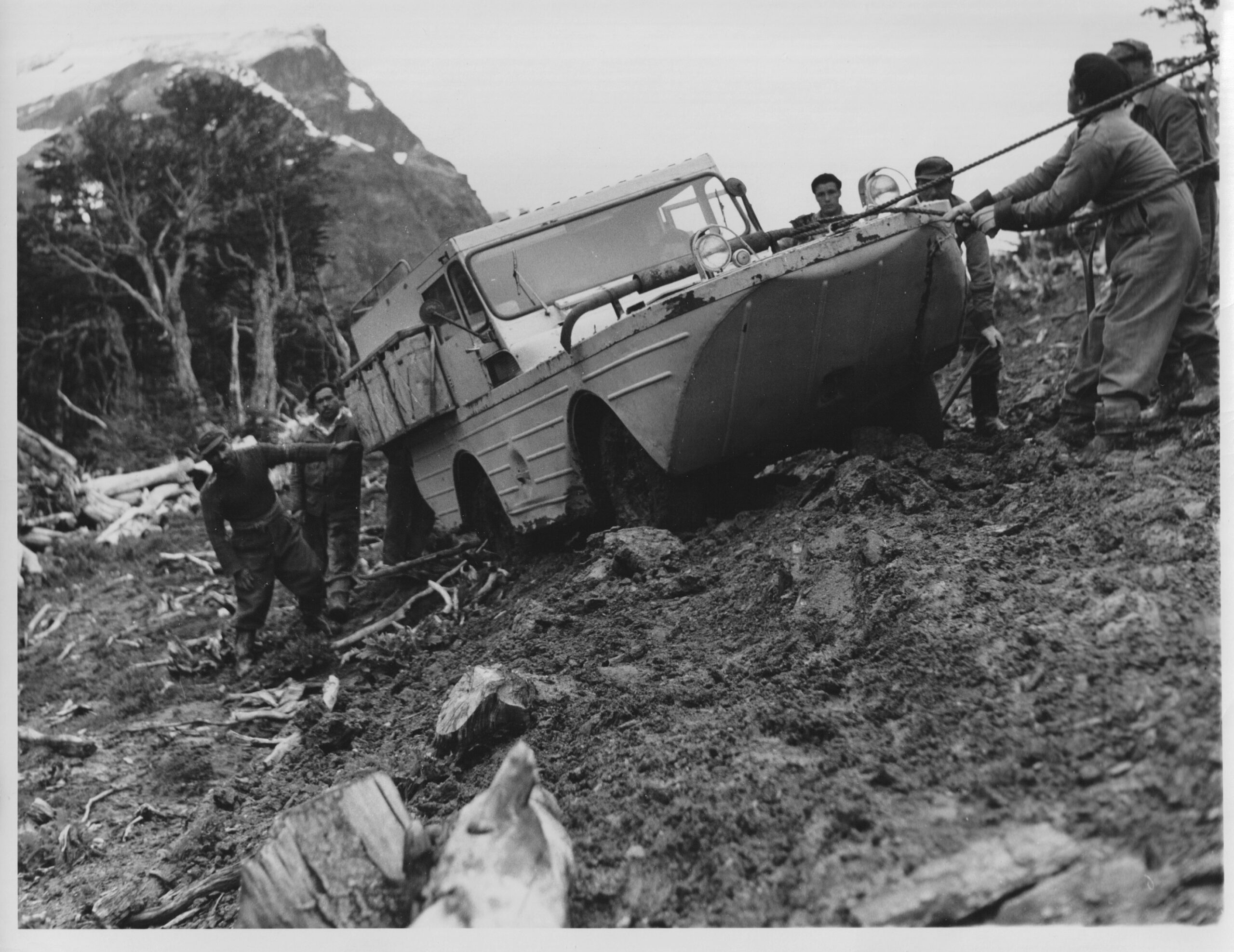
Frank served in the US Navy’s submarine service in the Pacific during World War II. According to Helen, he was an enthusiastic reader during childhood, which resulted in a passionate desire for travel. With a shock of thick brown hair, a knack for mechanical problem-solving, and the ability to winch the bulky Tortuga II out of just about any predicament, Frank was also the man behind the typewriter, undertaking much of the writing.

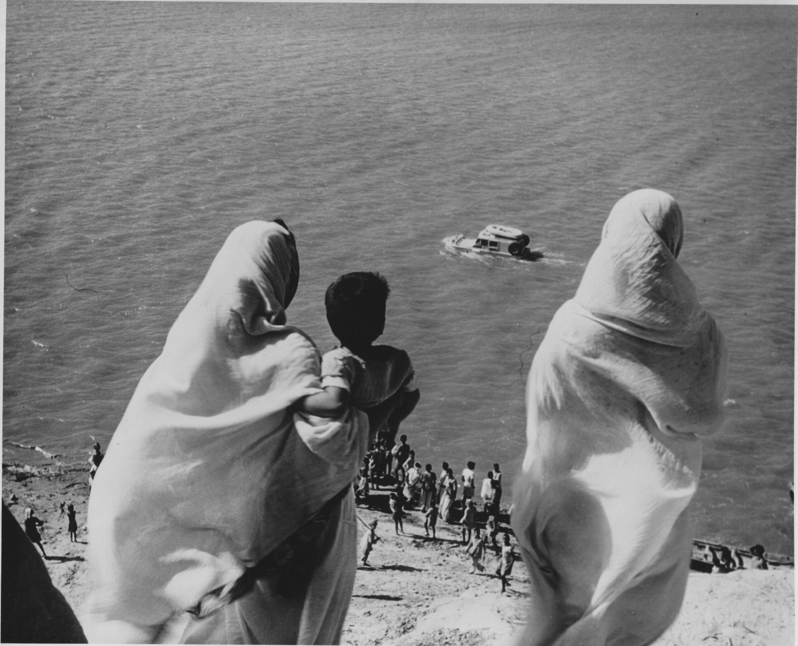
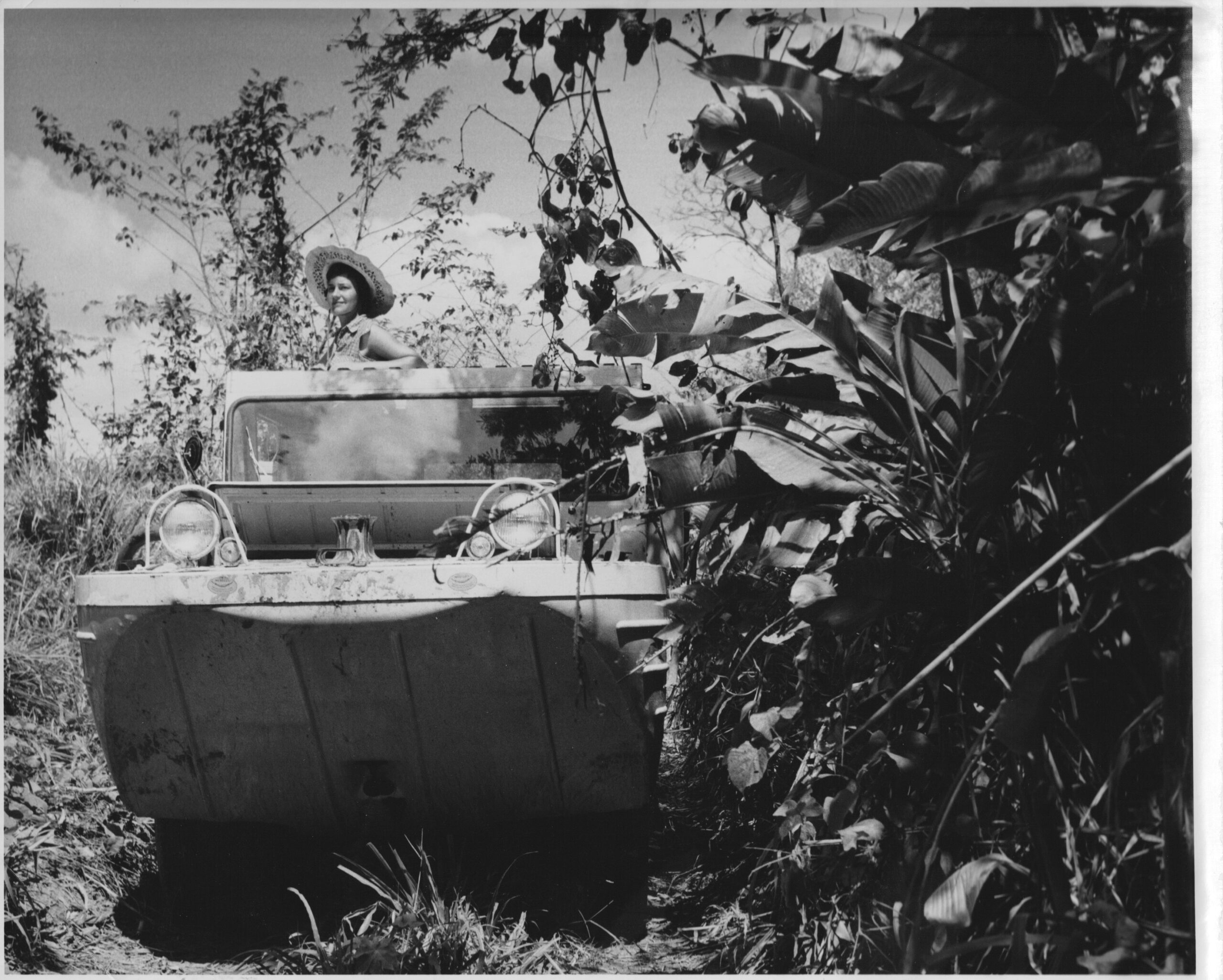
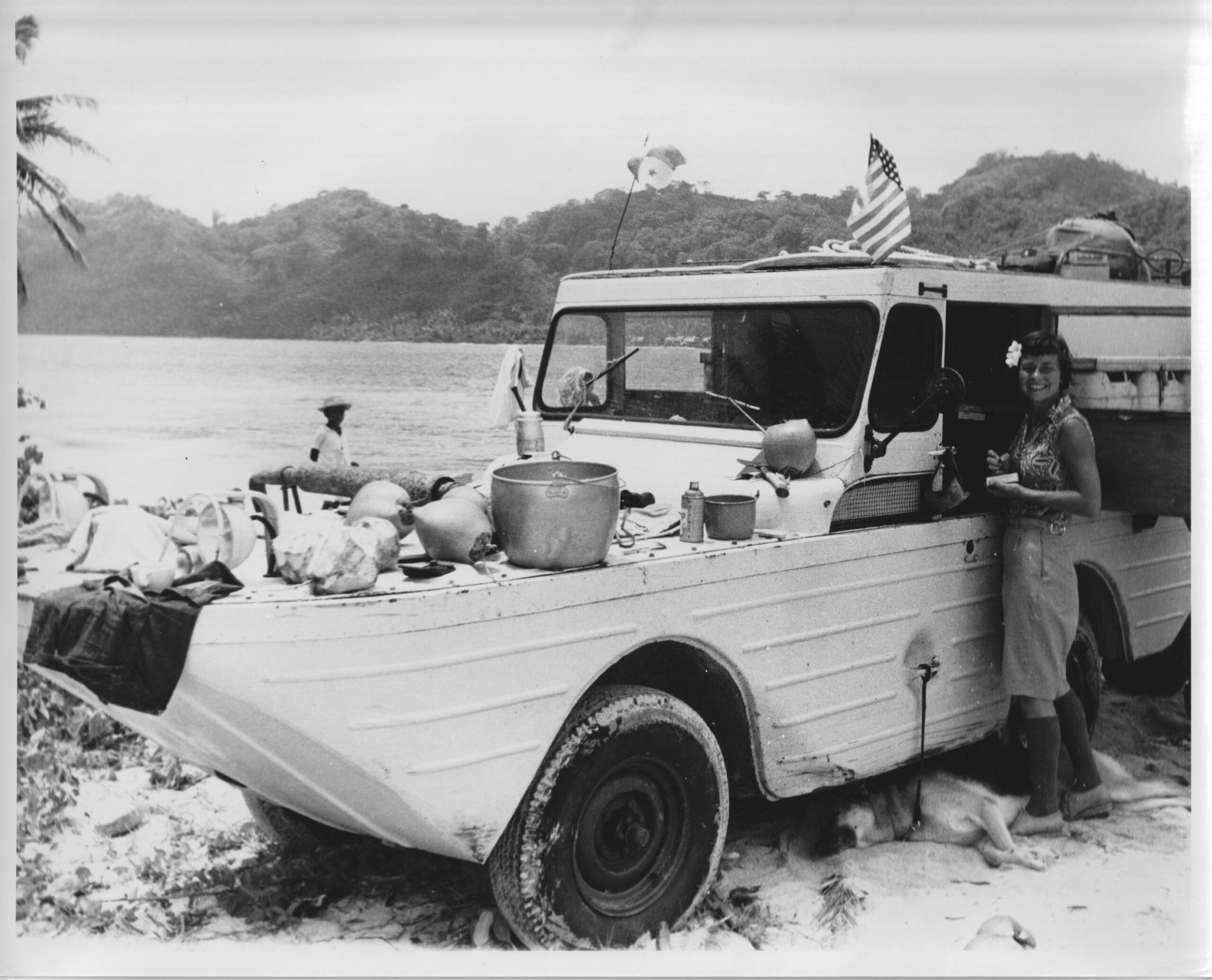
An avid drawer and painter, Helen took most of the photographs during the couple’s expeditions. Whether she was piloting Tortuga II up the Ganges River in India or wild camping on Indonesian beaches, her crisp sundresses and well-tailored outfits displayed an elegance and put-togetherness of the time. Don’t let her wide smile and knack for pulling off a short pixie cut fool you, though. While she didn’t enjoy crossing shallow reefs or pushing the limits of the Jeep’s camber off-pavement, Frank marveled at his wife’s ability to remain calm, quietly murmuring encouragement during raging sea storms off the coast of Panama or in response to concerning sounds emanating from Tortuga II’s engine while grinding up a steep shingle beach at Timor. Her response to Frank’s seemingly wild and crazy ideas was often, “When do we leave?”

schreiders helen

schreiders helen

The inception of the Indonesian expedition arose five years earlier, on a journey from Alaska to Argentina. At a busy Peruvian café in Callao, with views of ocean swells and soaring gulls, an elderly Dutchman invited them to join his table. “I would have given anything to have had a vehicle like yours when I was in the Indies,” he said, referring to the first amphibious Jeep they used to bridge roadless sections of the Pan-American Highway.

Over cold pisco sours, the former tea planter told the Schreiders of Komodo’s dragon lizards and Lubu tribesmen who lived in trees and hunted with blowpipes. “On the green cool nights, with the rice fields silver in the moonlight, he used to sit under a banyan tree on Java and listen to the music of the gamelan or watch a shadow play,” reads Frank and Helen’s travelogue, The Drums of TonkinThe Dutchman continued, “That was paradise on earth.”

However, when the Schreiders landed in traffic-filled Jakarta, they were greeted by a troubled country in a state of emergency where journalists were under special surveillance. “This then —ruinous inflation, banditry, civil war, martial law—was the state of affairs when we arrived in Indonesia,” Frank wrote. But they weren’t in the country to report on President Sukarno’s nationalist agenda or bandit terrorism. The couple was searching for something else: “the Indonesia of laughter and music, of dancing, painting and sculpture, the Indonesia whose cultural heritage, both indigenous and imported, at one time made it the greatest country in Southeast Asia.”

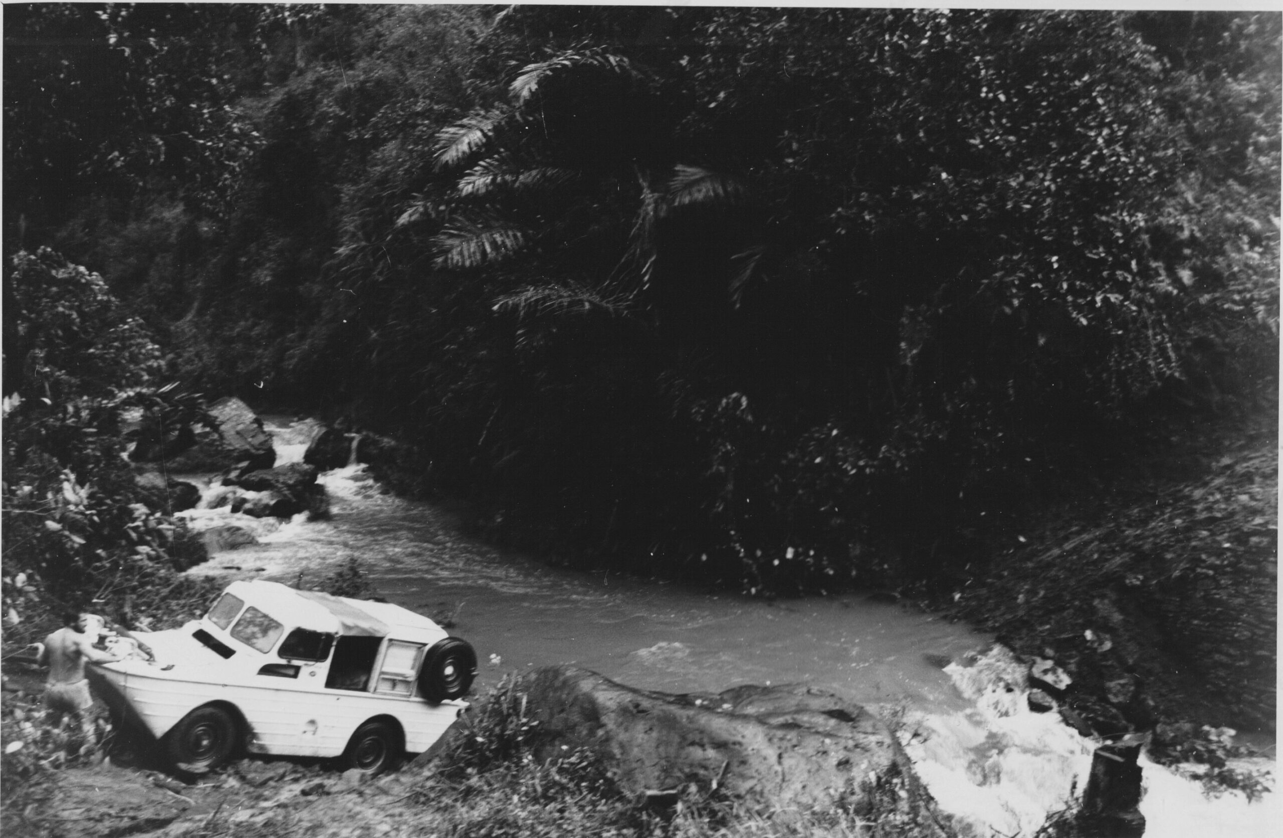
To access this “paradise on earth,” the Schreiders needed to jump through several hoops. First, they required a vehicle fit for the journey. The couple sourced a Ford GPA “Seep”—the amphibious version of the WWII Ford GPW Jeep—from a surplus depot in California. Because the Seep’s WWII production was quickly terminated due to poor field performance (“It had the unpopular habit of sinking with no more provocation than a ripple,” Frank noted), the couple’s work was cut out to transform the blundering beast into a liveaboard boat truck.

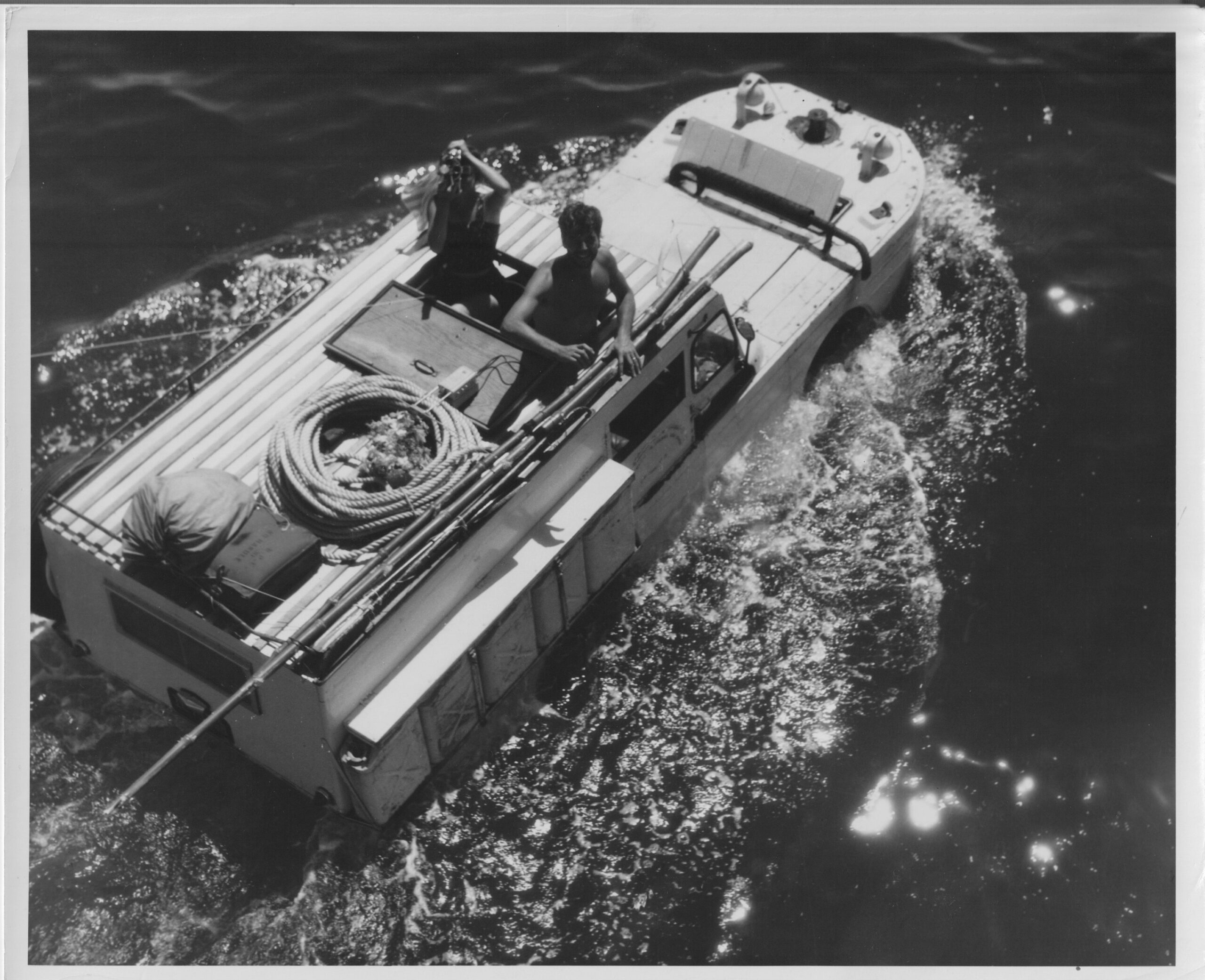
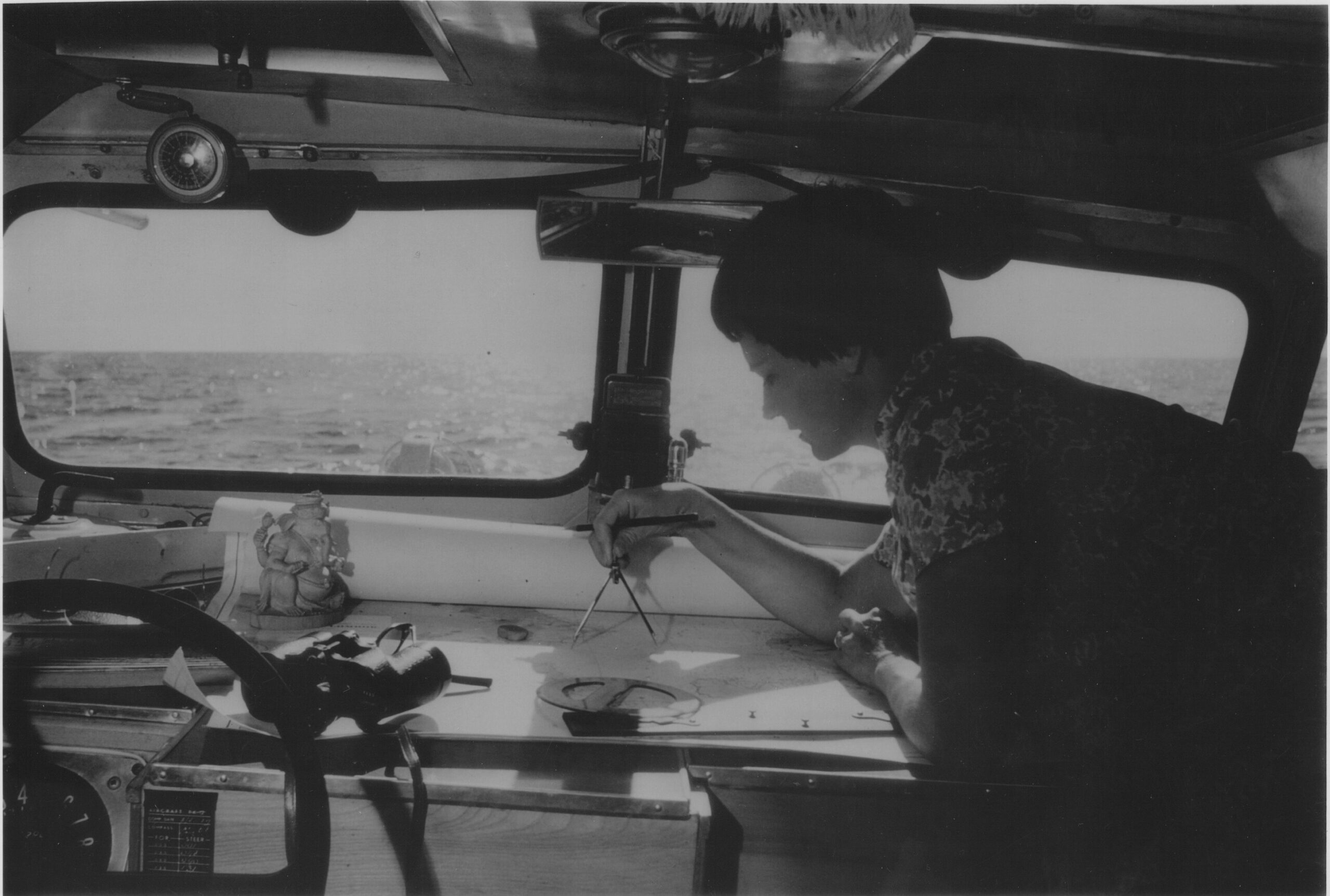
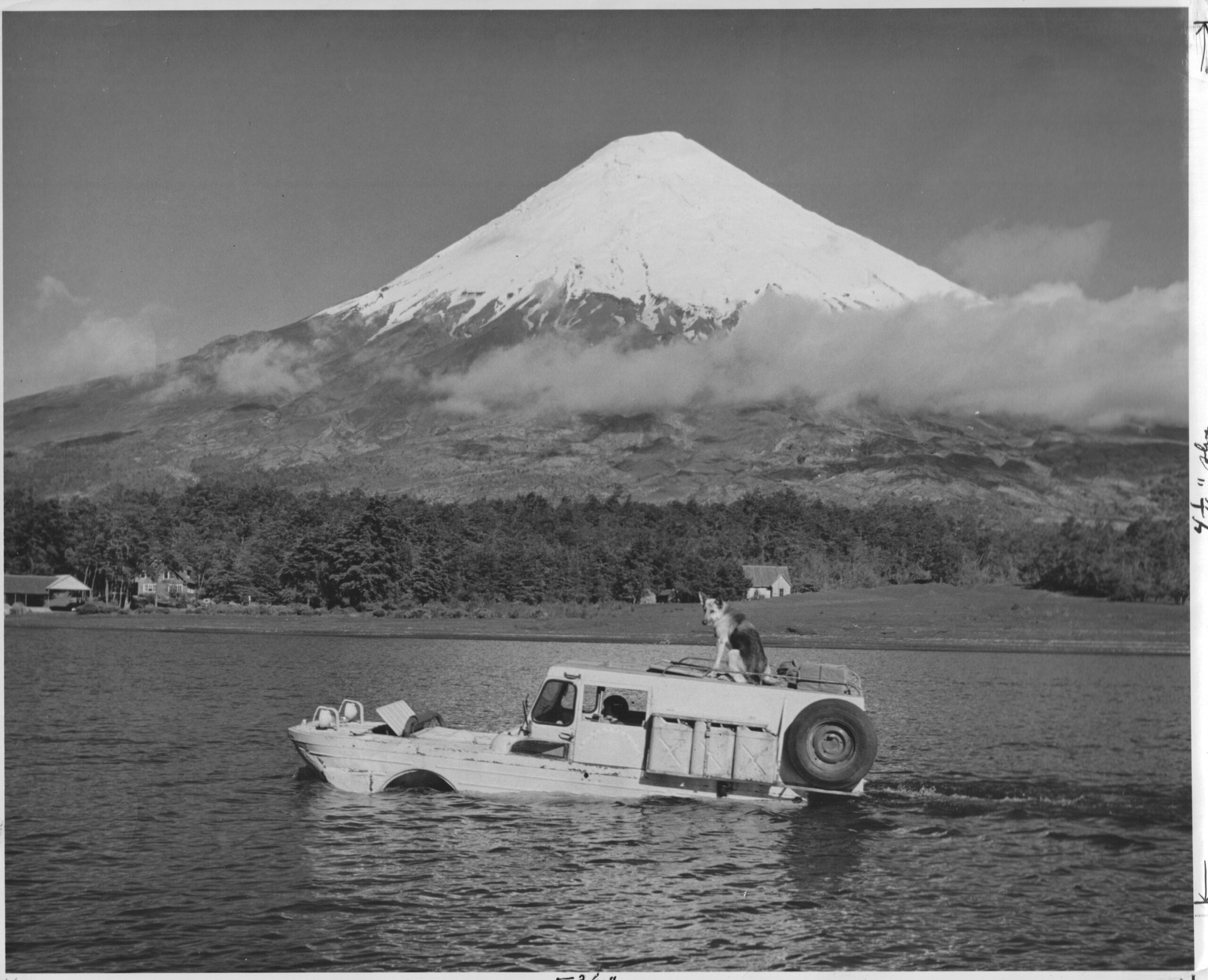
A propeller at the rear and a rudder connected to the steering wheel by steel cable made the vehicle seaworthy, while drive shafts running to all four wheels allowed the Schreiders to eventually leave Jakarta, breathing in the scent of frangipani and chilis cooking in coconut oil as they passed nearby fishing villages. The 15-foot Tortuga II was equipped with a dual-cooling system for sea travel, a calibrated compass, and a chart table for navigation. The enclosed galley featured an alcohol stove and tiny sink with water piped from a 10-gallon tank in the bow. Cabinets held enough tinned food for two months off-grid, and fuel tanks carried enough gasoline for 150 miles at sea or 270 miles on land. The Standard Vacuum Oil Company arranged for 300 additional gallons of gasoline and motor oil to be delivered by prahu, a traditional Indonesian sailboat, to the main islands along their route.

Schreiders tortuga II

Painted white with cherry red wheels, Tortgua II turned heads wherever it went. In Jakarta, the seafaring Jeep evoked a big grin and thumbs-up from local traffic police, who exclaimed, “Bagus, tuan!” or “Okay, sir!” in response. Outside the capital, the strange “land ship” attracted children by what Frank described as “that unexplainable aura that exudes from anything or anyone strange to the countryside,” drawing the elders to investigate and invite Frank and Helen, once they confirmed their nationality was American and not Dutch, to their village to observe a ceremony or share a cup of tea.

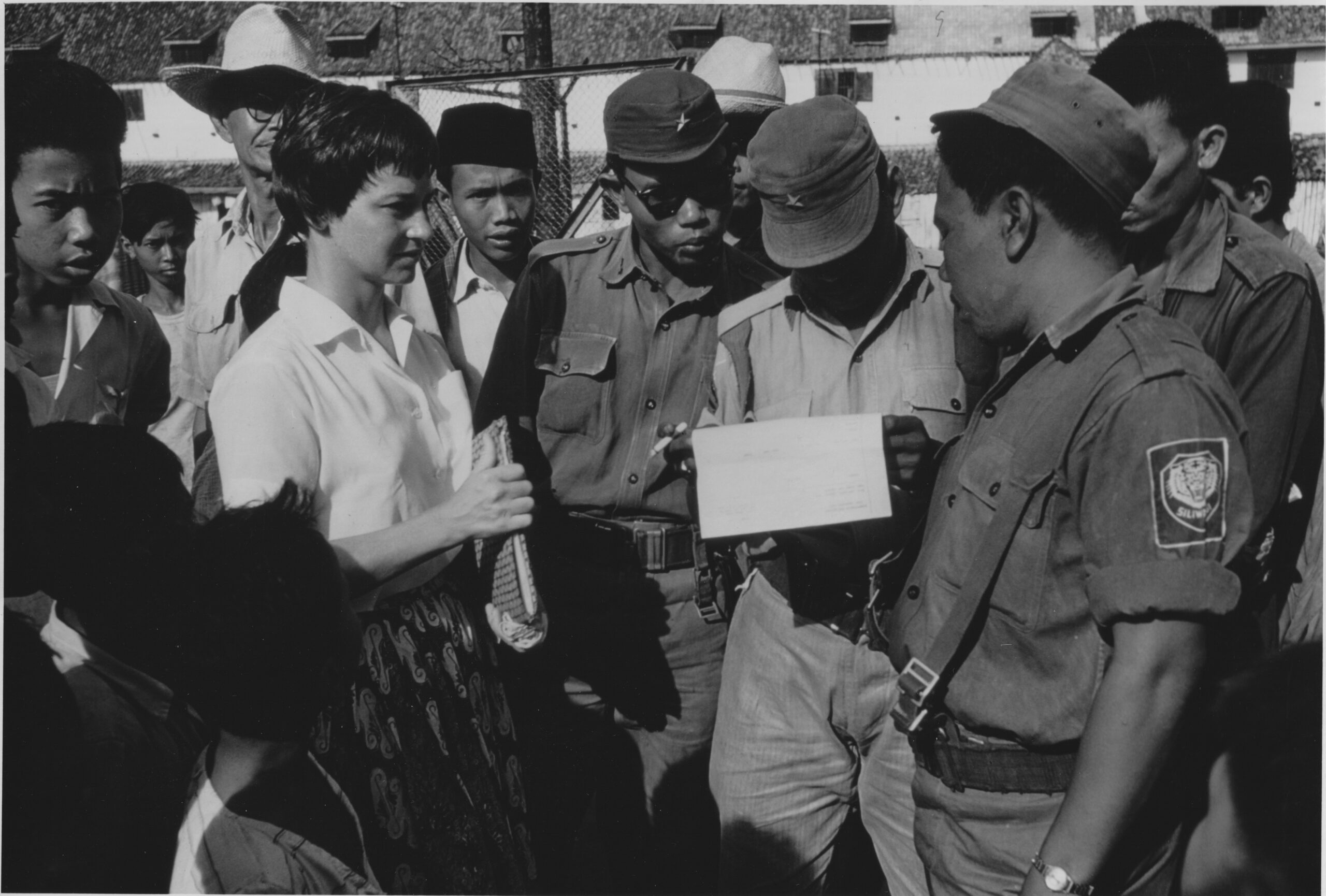
The next logistical challenge was a bureaucratic one. The Schreiders were required to register with the local police across the country, securing permits to take photographs, eventually leaving Jakarta with a letter from the colonel of military intelligence requesting all authorities assist them on their journey. One morning, after they made a wrong turn while driving to the prerequisite government offices to secure additional permits, a sentry man shot at their vehicle with a .30-caliber gun. Arriving at the military commandant’s office, the officer smiled apologetically. “But you know, Indonesia is in a state of war and emergency.”

Schreiders indonesia

A basic understanding of Indonesia’s complicated political and economic climate during the Schreiders’ visit in the early 1960s requires a brief history lesson on the country’s path to independence and the events that spiraled from it. Indonesia proclaimed independence on August 17, 1945, marking an end to Japan’s World War II occupation and 350 years of Dutch colonial rule—at least temporarily. Only after another four years of guerrilla warfare, in which Dutch forces burned villages and carried out mass detentions, torture, and executions, were the Indonesians granted independence (minus West Papua, but that’s another story).

Indonesian scholar and historian Dr. Taufik Abdullah identifies a multi-faceted Indonesian identity in the 1950s—a country that had achieved independence and was working toward democracy, press freedom, and a new constitution; and an Indonesia plagued by political instability, institutional weakness, and a struggle for power. The Indonesian people had experienced a war and a revolution. “It was also a post-colonial state, which implied it was primarily designed to control and extract, not to support a nation and guarantee citizenship,” Abdullah wrote in Indonesia: Towards Democracy in 2009.

By the early 1960s, a power struggle was well underway between President Sukarno, the army, the Communist Party, and rebel groups. Sukarno called for strict government control, curtailing freedom of the press, radio, speech, assembly, and movement. That was a problem for two journalists looking to journey to the far-flung reaches of the country.

A few miles out of Jakarta, Frank and Helen sighed deeply, relishing the scents of freshly churned earth and drying coconut flesh. “Away from the suffocation of Jakarta’s delicately balanced protocol and red tape, its tensions and superficial gaiety, its restrictions and registrations, we felt a new lightness and freedom,” Frank wrote. In Bali, amid Galungan festival celebrations, the pair attended a cremation ceremony. Flames licked at the wooden cremation tower, which was decorated with gold and silver streamers and glass chips. Shouts rang out to frighten evil spirits while an orchestra of “bamboo rattles, flutes and xylophones played a happy melody.” On Lombok, the Schreiders were invited to attend a circumcision ceremony from a neighboring village chief and joined a celebratory feast complete with buffalo meat curry and “mounds of rice, eggs fried in coconut oil, tiny silver fish eaten whole” and cone-shaped sugared rice and coconut.

Schreiders at sea

Eventually, the duo arrived in Komodo to observe the renowned 5-foot dragon lizards named after the island. But with half a thousand miles to go to Timor and an approaching monsoon season, they didn’t have time to linger as they liked and quickly prepared to leave for Flores, the next largest island to the east. Komodo was where the local chief informed the Schreiders that the road they so desperately needed no longer existed.

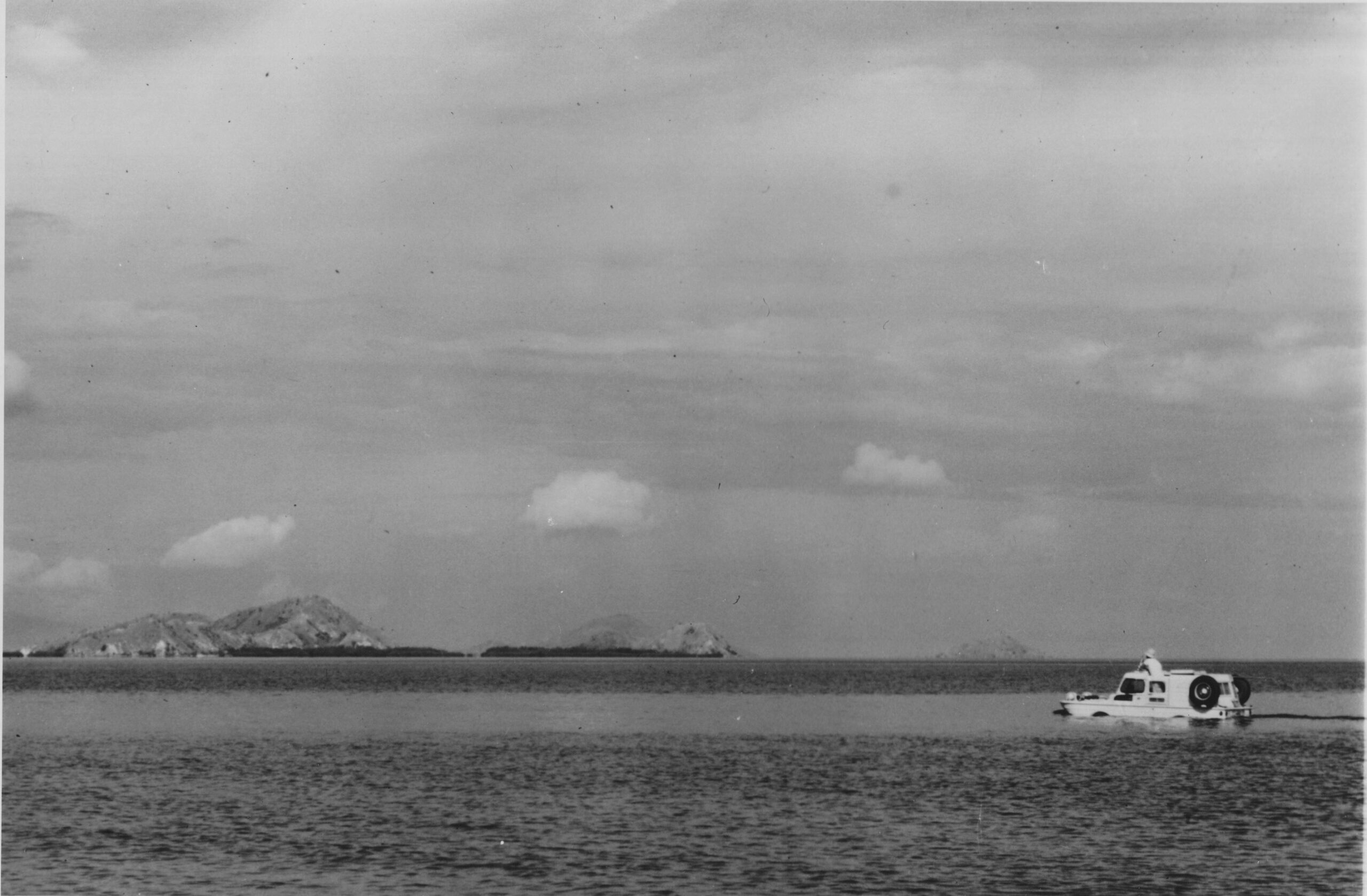
Despite the risk of draining their fuel and water tanks well before reaching land, Frank and Helen took off from Komodo in the early morning. Opting to use the ebbing current to push the Jeep toward Flores, the route was the shortest but far from the safest. However, there was a slim chance that if they used the current to their advantage, they might reach Flores before their tanks ran dry. “Rocks and islands sped by at what seemed full-throttle speed with but a whisper from Tortuga’s exhaust,” Frank wrote. “And the sea life, heretofore shy of an engine’s foreign sound, was bolder.” Leaping marlin and graceful whale sharks, leaving a trail of bubbles, kept them company while 6-foot-long sea snakes swished through the translucent water beside the Jeep.

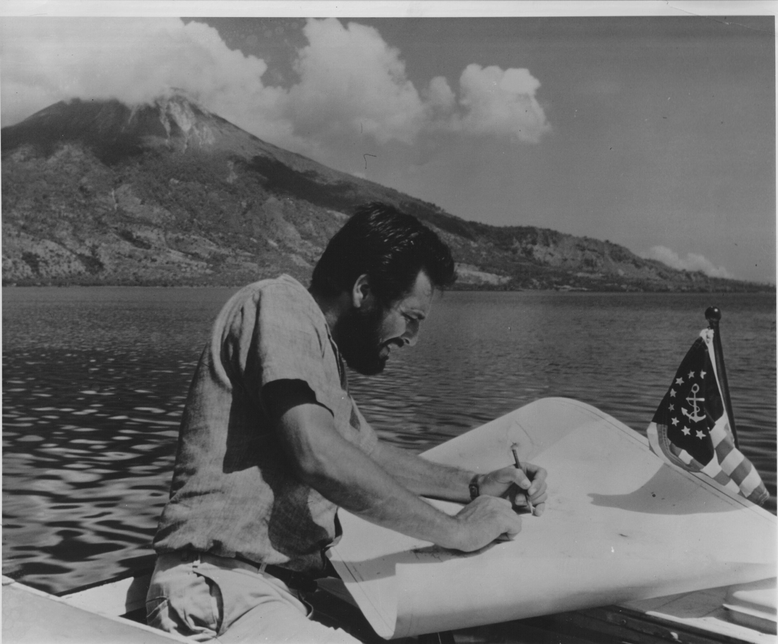
Schreiders frank mappingSchreiders helen mapping

As Helen and Frank continued along the coast, their charts, which were the most up-to-date available, became more inaccurate. No extensive survey had been completed of the area since before World War II. Unexpected reefs appeared, and landmarks to plot vanished. Using a bamboo pole to check the depth before crossing shallow waters above glowing mauve reefs, they spotted blue starfish and spiny black sea urchins. “By the fifth day out of Komodo, our spare fuel tanks were dry, our main tank was considerably less than full, and our drinking water was almost gone,” Frank wrote. The gas gauge developed an “erratic flutter” while the waves rocked Tortuga at precipitous angles.

By the time they were 15 miles from Reo, the gas gauge had stopped fluttering, hanging instead at the empty mark. “We looked for a place to land, but dark scrub jungle and mangrove roots reached like fingers into the sea,” Frank wrote. “There was no place to beach Tortuga.” The Schreiders crept closer to shore for another hour, the fuel pump sucking air while the engine sputtered. Finally, with only four miles of fuel remaining, they landed on a smooth beach on the outskirts of Reo. A surprised crowd gathered on the beach; one of the men brought a coconut for Helen.

But within minutes of their arrival, a truck sped down the road from the main part of town. Frank noticed a “strange hush fell over the crowd” as the truck “careened over a small bridge and skidded to a stop near an old concrete pillbox.” Restraining a growling Dinah, the Schreiders eyed the Indonesian Army lieutenant joined by a platoon of helmeted soldiers as they inundated the crowd. Strapped with submachine guns and automatic rifles fitted with bayonets, the crew sported “the mottled jungle-combat camouflage uniform of olive-drab and green.”

How ironic, thought Frank, to sweat out the long voyage from Komodo only to become the major characters in an “incident” on Flores. The sergeant, approaching the couple, reached to grab something from a wooden case in the back of the truck. “Welcome to Flores,” he said, and with a wide grin, handed them a bottle of warm beer.

As Frank and Helen’s 5,000-mile, 13-month Indonesian expedition drew to a close, they knew they had experienced much of what the old Dutchman idealized about the country. But, as Frank wrote, “We had found so much more.”

Shortly after, the Schreiders were hired full-time by National Geographic. Their next assignments involved exploring Africa’s Great Rift Valley by Land Rover, following in the footsteps of Alexander the Great from Greece to India (also by Land Rover), and, finally, mapping and navigating the length of the Amazon River.

The couple continued with National Geographic until 1970. Frank went on to write as a freelancer and continued his seabound capers aboard his boat, Sassafras. He died suddenly of a heart attack while moored in Crete on January 21, 1994.

Helen joined the National Park Service as a museum designer and continues to paint to this day. At age 89, she was inducted as a National Fellow into the Explorers Club in 2015. Frank was made a member in 1956, but the club didn’t allow women until 1981.

The Schreiders published several books, including 20,000 Miles South: A Pan American Adventure (1957), The Drums of Tonkin: An Adventure in Indonesia (1963), and Exploring the Amazon (1963).

schreider seafaring jeep

Editor’s Note: Indonesia by Amphibious Jeep was originally published in Overland Journal’s Fall 2023 Issue.