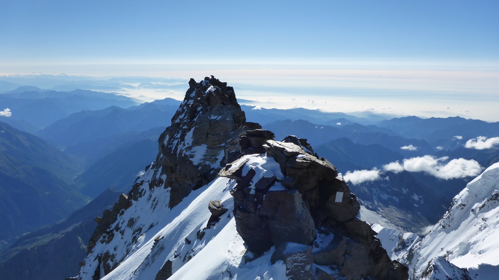
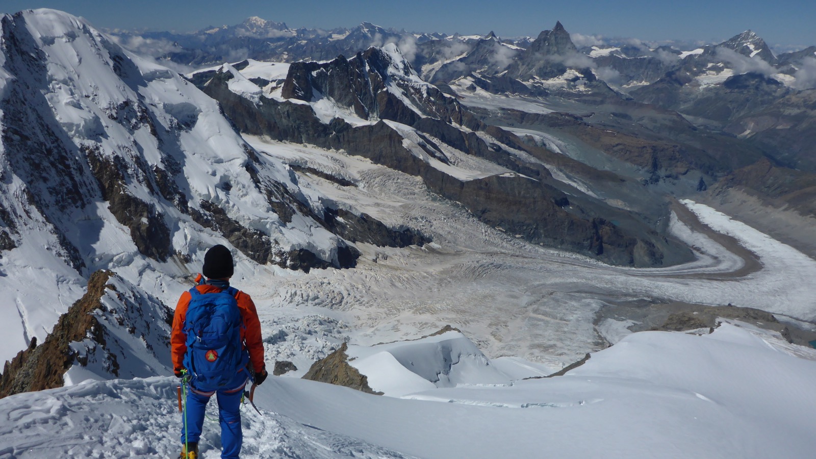
View from the summit towards Dunantspitze
Dufourspitze 4634m (HB/VS-001), the culminating point of the Monte Rosa massif, is the highest summit of Switzerland, and the second-highest of the Alps and western Europe. After a long planning phase to find the right day with the right weather, and where we (HB9GIN, HB9FVF and HB9DQM) would all be able to get away from work, we succeeded with the first activation of this summit on Wednesday, 15 August 2018.
Preparation
In order to get acclimatised to the altitude, and as a small test of our rope team (first high mountain tour in this constellation, no mountain guide), we activated Breithorn 4164m (HB/VS-018) two days before on Monday, for lack of a better option given the weather conditions. Breithorn is one of the easiest 4000ers of the Alps, as it is located very close to the Klein Matterhorn aerial tramway top station at 3883m – the highest place one can reach in Europe by a means of transport (except for helicopters ). It is therefore very popular, and despite the bad weather with fog and high winds, lots of people were on the way to the summit. Our activation lasted only the bare minimum of time to get 4 QSOs for each of us, as it was very cold, and our devices were covered in sleet within minutes.
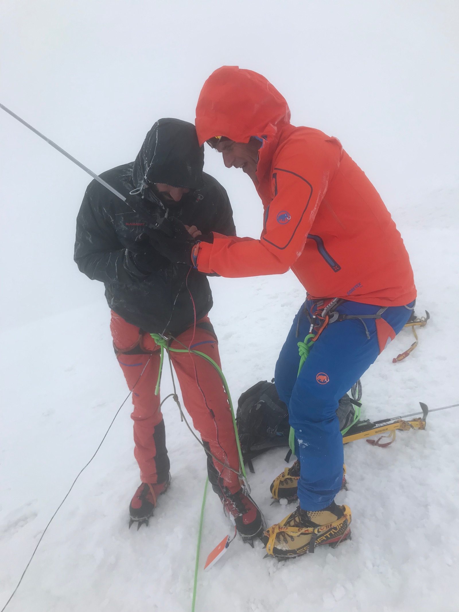
Hut
The base camp for the normal route to Dufourspitze is the Monte Rosa Hut, a remarkably high-tech hut built in 2009 and located at 2882m near Zermatt. Getting to the hut requires a 3-4 hour hike from the Rotenboden station of the Gornergrat railway, crossing the terminus of the Gorner Glacier.
On the way to the hut
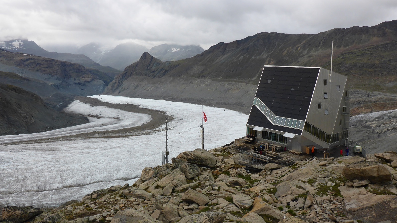
Monte Rosa Hut overlooking Gorner Glacier
We arrived at the hut on Tuesday afternoon. After a delicious dinner, we went to bed at 20:00 and tried to find some sleep.
Ascent
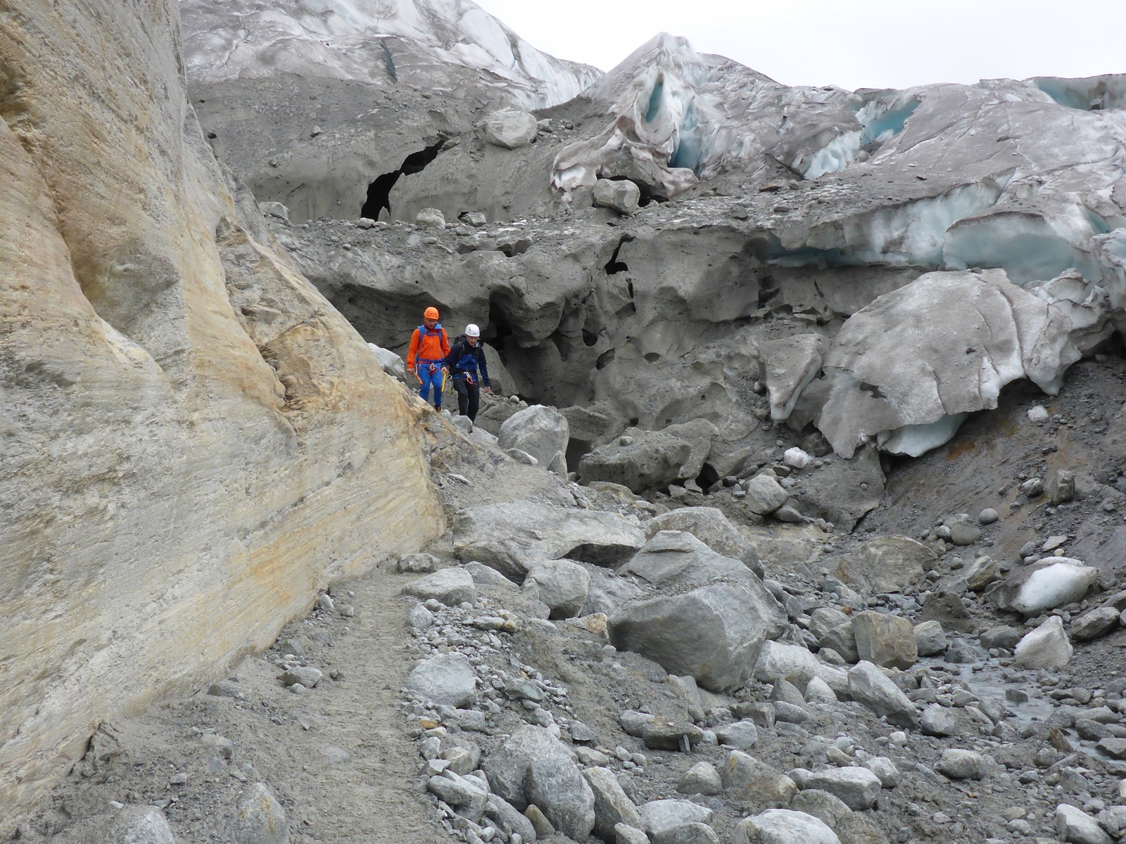
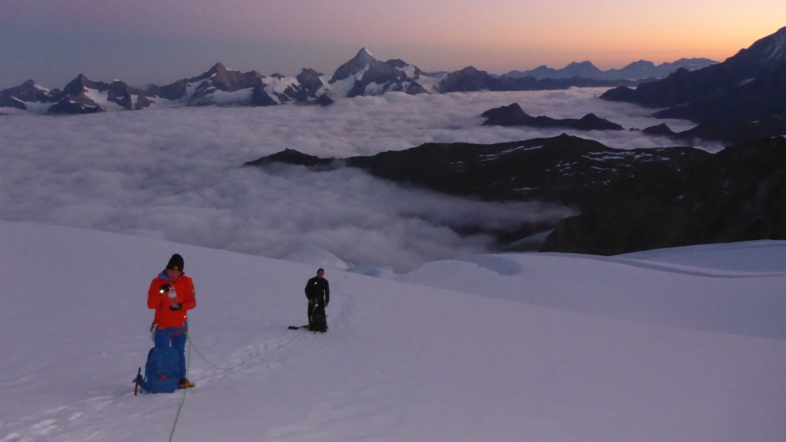
The normal route to Dufourspitze via the west ridge involves an ascent of 1880m from the hut, with grade II+ climbing on the exposed ridge. It is considered more difficult than the normal route to Mont Blanc. We got up at 02:00, had breakfast, and then set off in the dark as one out of six rope teams that day. First, we had to find our way through a confusing stone run between the hut and the Monte Rosa Glacier. Thanks to Matt’s preparation and route finding skills, we soon left the other rope teams behind, despite deliberately conserving our energy. Looking down, we could see their headlamps straying in all directions .
.After about an hour, we reached the glacier, roped up and put on our crampons. In the lower part, numerous crevasses had to be crossed/jumped over. While we were on the way to the col in the west ridge of the summit, the sun rose, creating a very special atmosphere in these high alpine surroundings.

We eventually reached the col, and after a quick break, started climbing the ridge. Care had to be taken as the ridge is exposed, and was partially covered with snow – there were plenty of opportunities to become SK by a slight mistake.

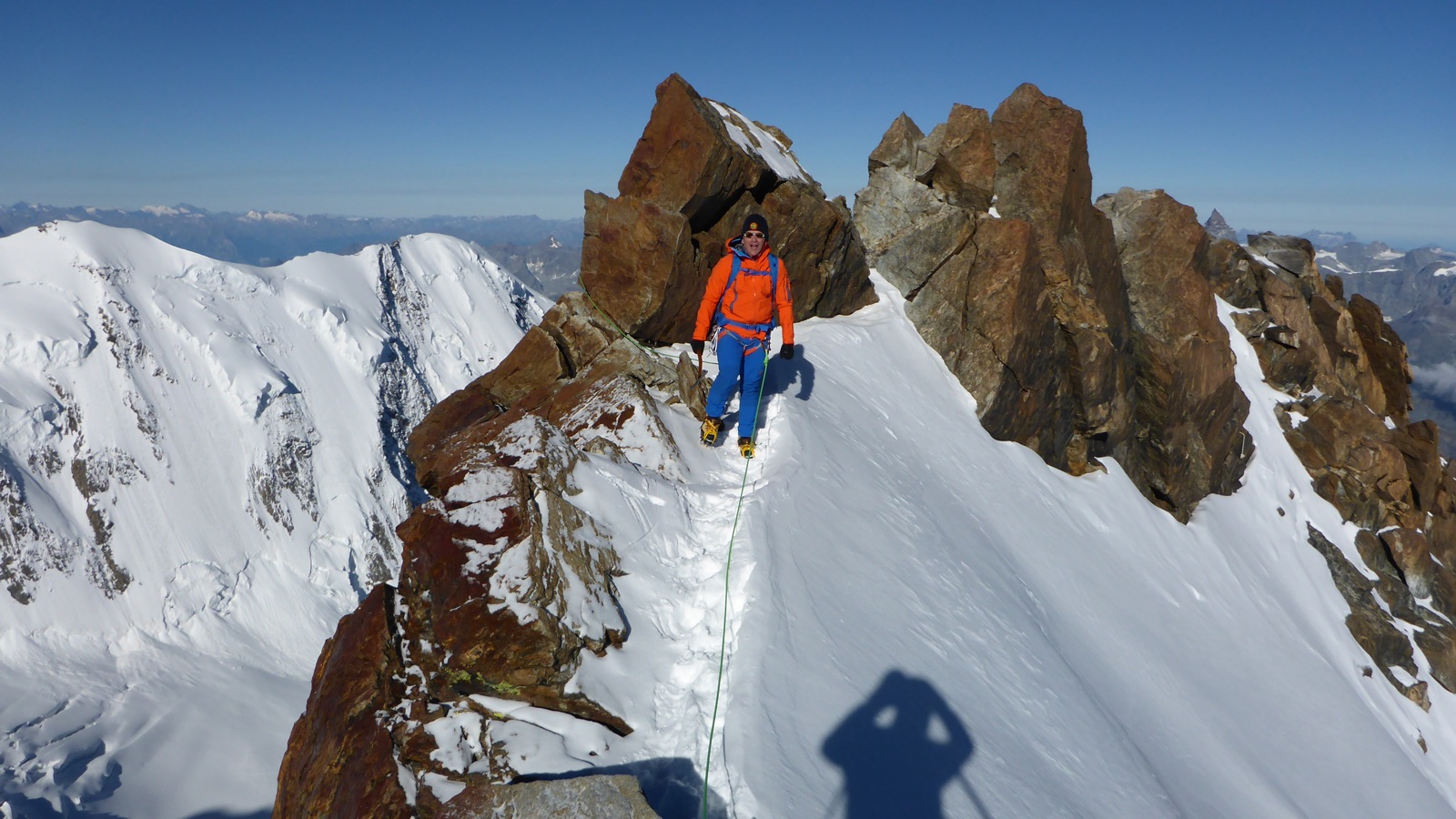
Two fun and easy parts of the ridge (for some reason nobody took out the camera while in the harder ones
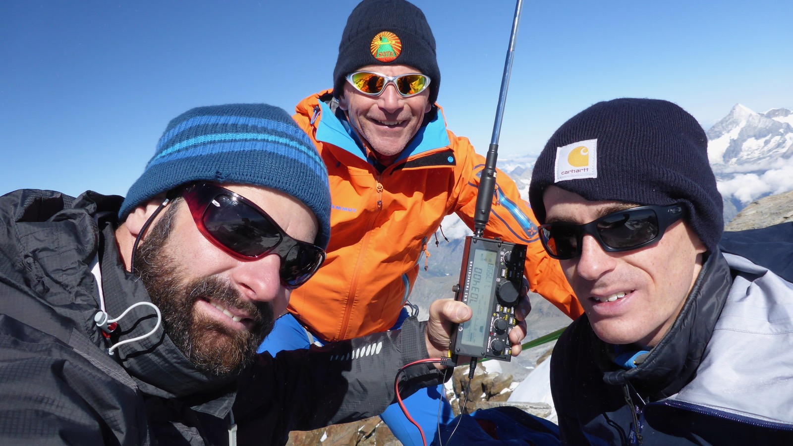
)After about 6.5 hours, we reached the summit in perfectly sunny weather, and admired the view down to all the lower mountains and valleys.
Activation

Using a KX2 with an MFJ whip for 40m + counterpoise wire, we started operating with the HB9SOTA club callsign, then switching operators so each of us would also get at least 4 QSOs on their personal callsign. Spotting proved to be difficult due to a flaky mobile phone signal, and after a false/old APRS spot with the reference of Breithorn, Iridium spotting through my Garmin inReach Mini saved the day. We could all feel the altitude affecting us, as the operating (especially in CW) wasn’t as straightforward and fluid as on lower summits. The chasers were numerous and well-behaved – thank you! Having made a total of 21 QSOs in half an hour, we decided to go QRT, as the descent was very long and had to be completed before the snow bridges over the crevasses in the lower part of the glacier got too soft.
Descent
We descended by the same way as we had come. The ridge again required full concentration and good use of rope and tools to secure the most critical sections. The rest was a rather uneventful slog down the glacier.
Back at the hut, we had a drink, and then tackled the three-hour hike to the railway station. Tired but happy, we arrived back in Zermatt in the evening, where each of us went their own way.
If you’d like to see more photos, here’s a slideshow that Matt has put together:
No comments:
Post a Comment