Ham radio satellites are a wonderful addition to any Ham radio operator’s activity. Even Technician-class licensees have privileges that permit them to access 95% of the satellites currently in orbit. There is plenty of activity, and the entry point to using satellites is low in both equipment costs and skill required. Finally, satellites are not affected by the rise and fall of terrestrial propagation conditions.
In order to access a satellite, you need to know when it will be above your horizon. Then you need to be able to keep your antenna pointed at it as it crosses the sky. In this blog, I’ll give you common tips on tracking a satellite and keeping it audible when it’s overhead.
To accurately predict a satellite’s orbit, programs and apps use the satellite’s orbital elements, sometimes known as Keplerian elements. These data points are compiled to give an accurate position of a satellite. AMSAT, the Radio Amateur Satellite Corporation, has a page on its website that explain Keplerian elements in greater detail.
Prediction Programs Make Passes Possible
There are several ways to know when any given satellite will be accessible to you. One of the easiest is to go to the Pass Predictions page on the AMSAT website. Choose the satellite you want to track. Then enter your latitude and longitude or 6-digit grid square, and the number of passes into the future you want data for. You’ll get complete information on when passes start and stop, what azimuth the satellite will appear and disappear over the horizon, and the highest elevation the satellite will achieve during a specific pass. It’s an excellent tool provided by AMSAT.
Another great resource is N2YO.com. This website tracks all sorts of satellites; the link above takes you to the Amateur Radio sub-category of the site. There, you can track dozens of Ham radio satellites in real time, including the footprint, or area of coverage, a satellite has. The site even has alert features, so you can receive an email or text message when a satellite is about to be above your horizon for a pass.
Heaven’s Above is another popular satellite tracking website.

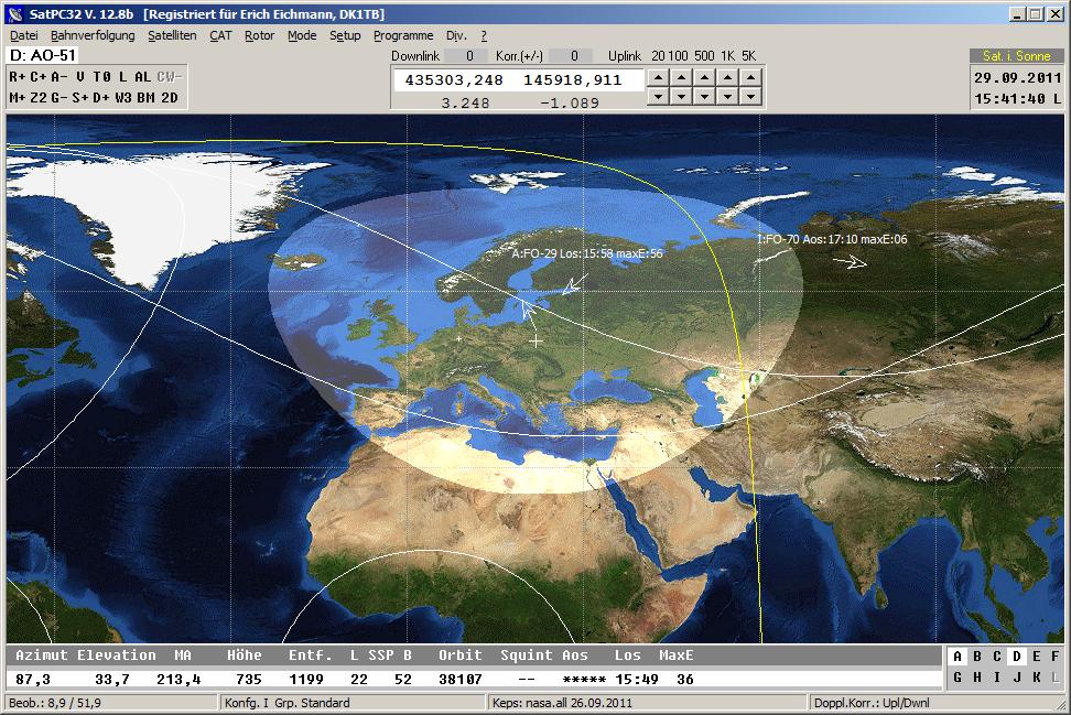
Lastly, if you have a home satellite station, look into a piece of software called SatPC32. Written by Eric Eichmann, DK1TB, SatPC32 is a complete station interface for the PC, which includes real-time satellite tracking, computer rig control, rotator control, and Doppler correction. Eichmann donates all proceeds of this software to AMSAT to help fund its programs.
Apps
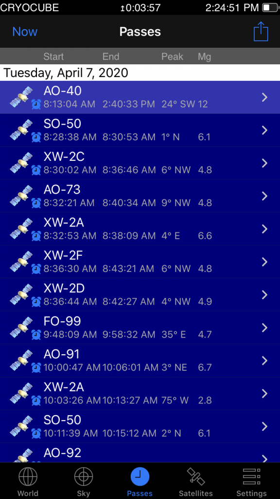
There are multiple satellite tracking apps available for smartphones. Apps offer the convenience of full satellite tacking in the palm of your hand based on your phone’s internal GPS data, which is critical data if you’re a portable satellite operator. They work wonderfully at home as well.
iOS
Apple users have a few options. One of the most popular is GoSatWatch. This app has it all: real-time tracking on hundreds of satellites, automatic update of Keplerian elements, alarms to notify you when selected satellites are going to be accessible, and live display of the satellite’s footprint so you know who is within range. It’s a powerful program, but it’s not free. GoSatWatch costs $10, but in my opinion, it’s worth every penny.

More frugal satellite operators can investigate SatSat, a free app that has nice features but is not as powerful or comprehensive as GoSatWatch. One feature SatSat offers that GoSatWatch does not is a list of the satellite’s uplink and downlink frequencies, as well as info on Doppler offset. That’s handy for newer operators trying to understand Doppler shift.
Android
Two of the most popular Android apps for tracking the birds are ISSDetectorProand AMSAT Droid. ISSDetectorPro is feature-rich and quite popular, where AMSAT Droid is simpler and slightly easier to use. There is also an app from the Heavens Above website mentioned earlier in this blog.
John Brier, KG4AKV, has compiled a list of various tracking apps and a feature-comparison chart on the Satellite FAQ page on Wikidot. I recommend trying a couple of different apps for your platform to see which one you prefer.
Tracking the Bird During a Pass
Once you know when a satellite is going to be overhead, the next issue becomes tracking it in real time. Unless you’re using an omnidirectional antenna, you will need to keep your antenna aimed at the satellite as it passes overhead.
Home Stations
If you’re operating from home, the best solution is complete station integration with a program like SatPC32. The software offers antenna rotor control, so it will automatically keep your antennas aimed at the satellite as it goes overhead. Combined with satellite tracking, complete rig control and assistance with Doppler shift, this program makes working satellites from home much easier.
If a fully computer-controlled station is not possible for you, manual control of your antenna rotor with azimuth and elevation control should be considered. It does require you to pay attention to the satellite’s position during the pass, but with practice, taking a few seconds every couple of minutes to adjust your antenna’s position will become second nature.
If you don’t have an antenna rotor that does both azimuth and elevation rotation, one solution is to use a standard antenna rotor (azimuth only, no elevation control) and permanently mount your antennas aimed at an elevation of 15-20 degrees above the horizon. This will allow you good coverage of most passes. Many satellite operators use this method of rotation with good success.
Portable Ops
If, like me, you operate satellites with a portable setup in your backyard or while on the road, you have a couple of options: handheld antennas or tripod mounts.
A tripod offers a lot of convenience. It frees up a hand to do other things and can facilitate a small tabletop to set up your gear. But there’s a significant trade-off that comes with that convenience: the ability to quickly reposition the antenna, especially when trying to compensate for polarization fading. As the satellite passes overhead, it is tumbling through space, meaning the orientation of the satellite’s antenna is constantly changing, relative to you on Earth. Deep nulls in the receive signal can occur if you don’t keep your antenna properly aligned to the satellite’s antenna. If your antenna is mounted on a tripod, it is more difficult to quickly adjust for a shift in polarization, and that could mean more fading when you’re trying to receive the satellite.
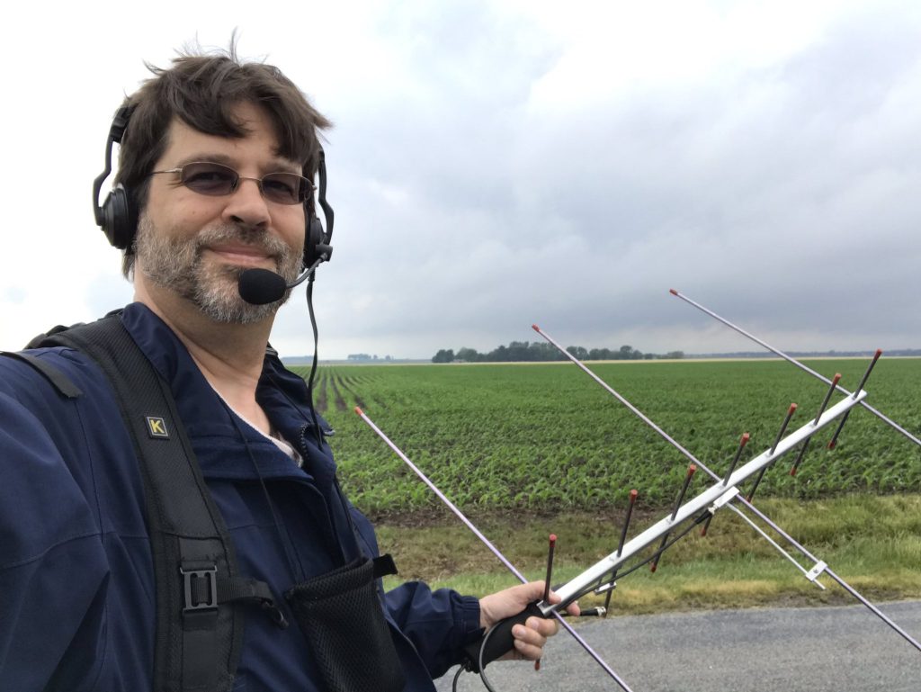
Most serious portable satellite operators use one hand to hold the antenna. This allows them to quickly and easily compensate for polarization fading on the downlink, resulting in easier copy of the satellite throughout the entire pass. It also makes it easier to keep the antenna pointed at the satellite as it tracks across the sky.

Conclusion
Many a budding satellite operator has been stymied by not having accurate information on the position of satellites. There is a wealth of data available now that should alleviate this problem. Use one of the sources I’ve listed here to know when a satellite will be workable for you, keep that antenna pointed properly as it passes overhead, and you’ll have more stations in your log.
Still have questions? Drop me a line atkx9x@yahoo.com and I’ll be happy to help.
No comments:
Post a Comment